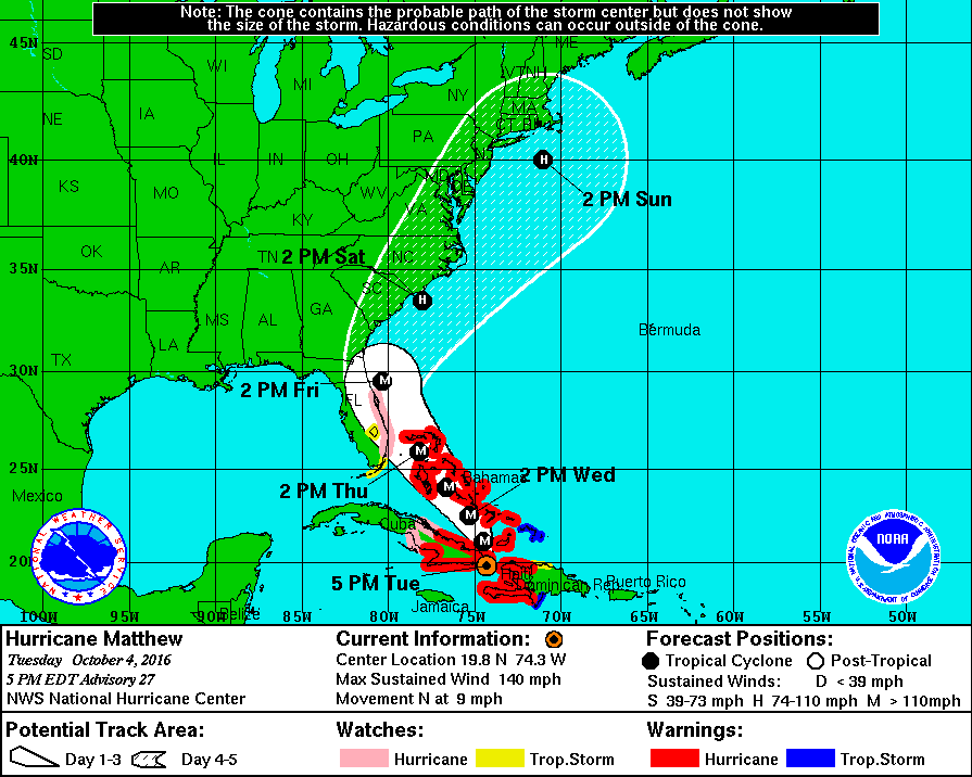
Hurricane Matthew at 2100 UTC has weakened slightly to 120 knots maximum winds due to the interaction of nearby land. Hurricane force winds extend outward 40 NM while 50 knot or higher winds extend outward 50-60 NM. Gale force winds extend out about 150 NM to the southeast and 60 NM to the northwest.
Once Matthew moves into the Bahamas, the environment is favorable for the hurricane to maintain category 4 status for the next 2 days. Some weakening is likely beyond day 3 due to increasing wind sheer.
Matthew is moving towards the north at about 8 knots, however, most models show Matthew turning more towards the northwest as it moves across the Bahamas Wednesday and Thursday then approaches the Florida East Coast during Thursday and Friday. Thereafter, a turn to the north then northeast should bring the center of Matthew near the SC/NC coasts on Saturday.
Matthew is likely to produce devastating impacts from storm surge, extreme winds, heavy rains, flash floods, and/or mudslides in portions of the warning areas in Haiti, Cuba, and the Bahamas.


