
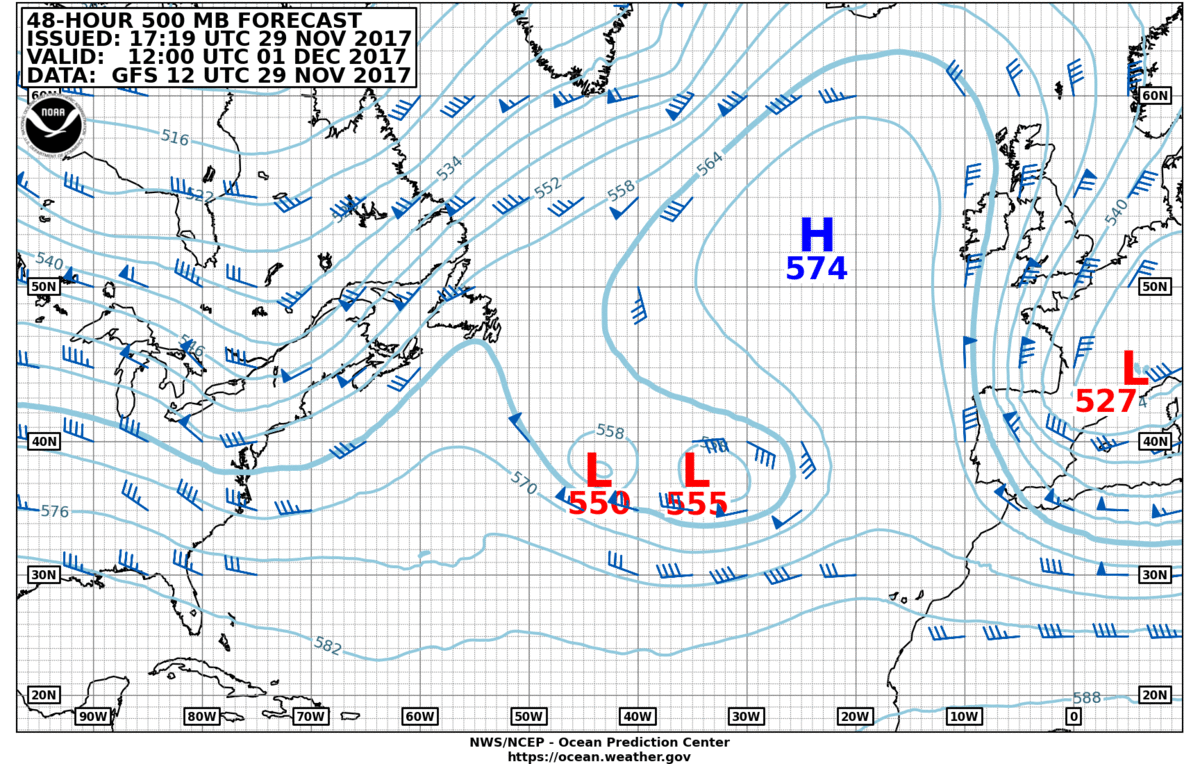
NOAA OPC 48 hour 500 mb forecast chart
The current North Atlantic upper-air pattern is developing an Omega block over the northeastern North Atlantic. This pattern gets its name because this upper air pattern looks like the Greek letter omega (Ω). Omega blocks tend to have two cut-off lows with one blocking high sandwiched between them. They also tend to be large in size, producing a persistent surface pattern.
Often the cut-off upper lows tend to dig southeastward into the lower-left portion of the omega which can, in turn, force the omega pattern to extend farther northward. This disrupts the normal southwest to northeast storm tracks which can allow options for minimum distance great-circle weather routes during winter from North Europe ports to US East Coast Ports.
Learn more about using the 500mb chart for weather routing.
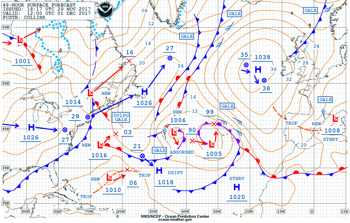
NOAA OPC 48 hour surface forecast.
Interesting
That high pressure system should be around where we are in the Azores. The result of this weather pattern is that we are experiencing English-type weather – albeit without the cold – in Terceira. The low pressure systems, which would normally track north of us are now to the south, bringing heavy rain and easterly winds. Hey ho!