Potential Tropical Cyclone Two nearing Caribbean

sat photo

Satellite Image with surface wind field

Potential Tropical Cyclone Two continues to produce vigorous deep convection and also exhibits some banding features, however, reports from an Air Force Hurricane Hunter aircraft indicate that there is no well-defined center of circulation.  Interaction with land and fast forward motion will likely limit intensification until the system reaches the southwestern Caribbean Sea later this week when significant strengthening is possible.

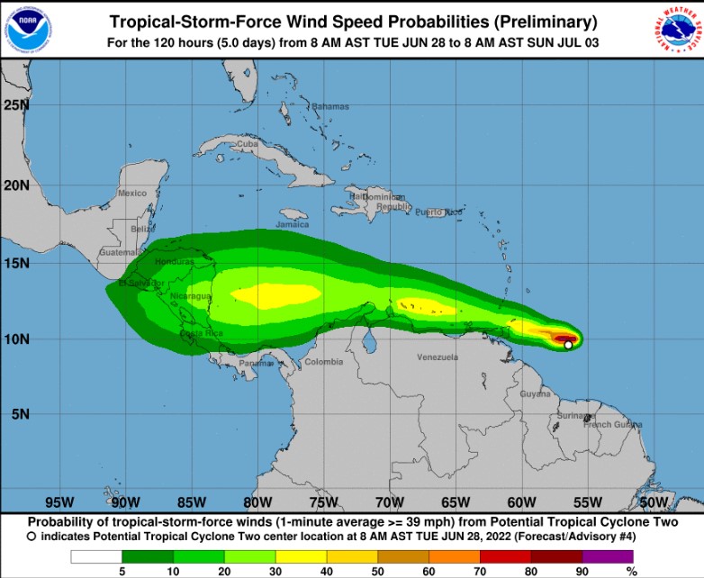
wind risk

NHC Risk for Gale Force (Tropical Storm) winds

Heavy rainfall is expected across the Windward Islands and northeastern Venezuela tonight through Wednesday. Winds to tropical-storm-force are expected over portions of the southern Windward Islands tonight, over Islas Margarita Wednesday morning, and over the ABC Islands by Wednesday evening.  Tropical storm conditions are possible along the northeastern coast of Venezuela tonight and Wednesday evening.

About Fred Pickhardt

I am a marine meteorologist and sailed briefly with American Export Lines in the Far East trade after graduating from State University of New York Maritime College. I have extensive experience in weather analysis, weather forecasting, optimum ship routing, vessel performance evaluations and forensic weather event reconstructions. I founded Ocean Weather Services and as Owner and Chief Consultant currently provide optimum ship routing services and forensic marine weather reports to the maritime industry.
This entry was posted in Cruise Weather, Ocean Storms, Tropical Cyclones and tagged , , , , . Bookmark the permalink.

Leave a Reply

Your email address will not be published. Required fields are marked *