

IR Satellite TS Ophelia
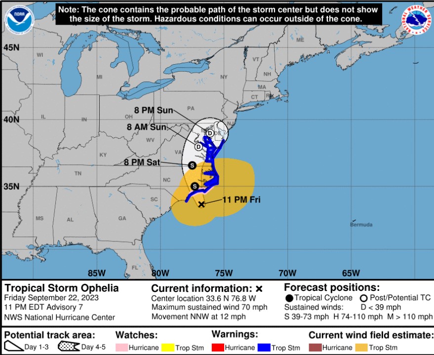
Tropical Storm Ophelia has strengthened to max winds of 60 knots and is moving north-northwestward (330 degrees) at 10 kt. Max significant wave heights are estimated near 8.5 meters (28 feet). The current track will take Ophelia’s center inland over North Carolina on Saturday, and then across portions of southeastern Virginia and the Delmarva Peninsula Saturday night and Sunday. There is a chance Ophelia could briefly reach hurricane strength just prior to landfall.
Weakening is expected once the center moves inland Saturday morning and the winds should drop below tropical storm force between 24 and 36 hours while Ophelia is over southeastern Virginia.
NHC Track Forecast
Tropical storm conditions are expected along portions of the southeastern and mid-Atlantic U.S. coasts through Saturday night. There is a danger of life-threatening storm surge inundation over portions of eastern North Carolina and southeastern Virginia, including Pamlico and Albemarle Sounds, the Neuse and Pamlico Rivers, the lower James River, and the lower Chesapeake Bay.
Heavy rainfall from this system could produce locally considerable flash, and urban flooding impacts across portions of the Mid-Atlantic states from North Carolina to New Jersey through Sunday.

Risk for 50 Knot (58 mph winds