
Typhoon Talim Satellite Image
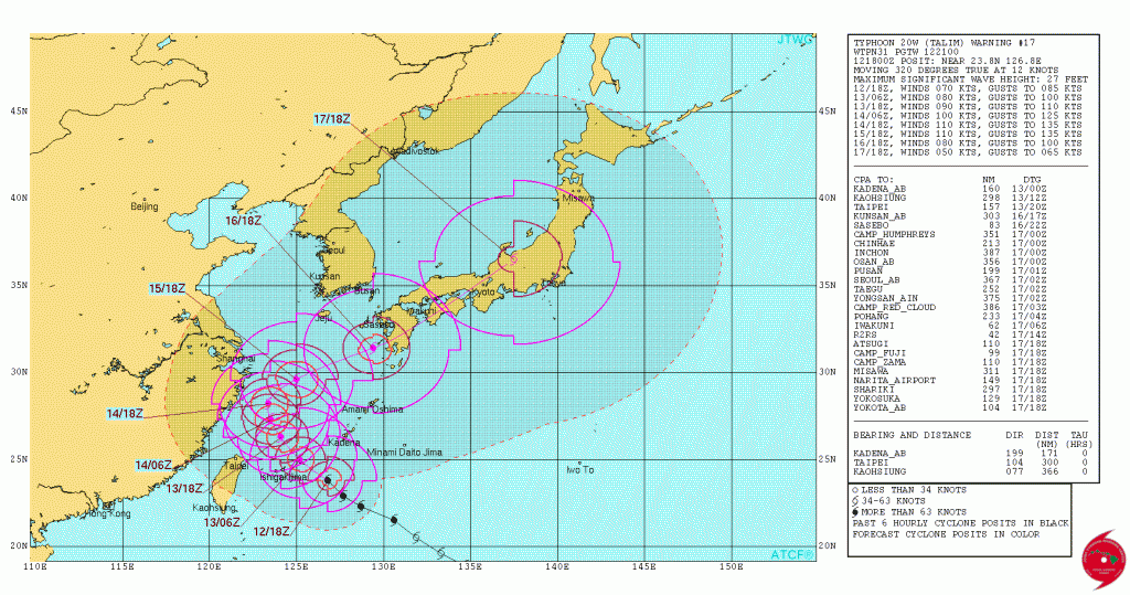
Typhoon Tali was located at 2100UTC 12 September, 2017 about 171NM S-SW of Kadena AB on Okinawa and was moving northwest at 12 knots with max winds of 70 knots. Hurricane force winds extend outward about 30 NM to the southwest and about 50 NM to the northeast.
Tali is forecast to move northwestward for another 48 hours before turning northward then northeastward reaching a peak intensity of 100-120 knots over the next 48 hours.
JTWC forecast track for Typhoon Talim
Post Views:
306
About Fred Pickhardt
I am a marine meteorologist and sailed briefly with American Export Lines in the Far East trade after graduating from State University of New York Maritime College. I have extensive experience in weather analysis, weather forecasting, optimum ship routing, vessel performance evaluations and forensic weather event reconstructions. I founded Ocean Weather Services and as Owner and Chief Consultant currently provide optimum ship routing services and forensic marine weather reports to the maritime industry.


