
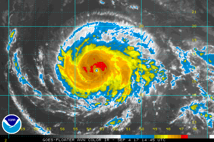
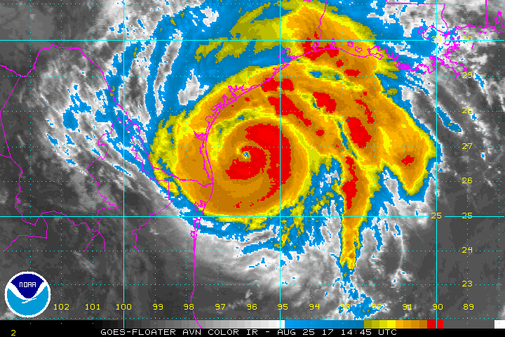
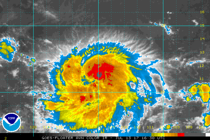
Hurricane Irma IR satellite photo: NOAA
Major Hurricane Irma, currently with max winds to 105 knots (120 mph) and a minimum pressure of 944 mb continues to move west-southwestward at about 11 knots. Hurricane force winds extend outward 20-30 NM while gales extend outward 60 NM to the southwest and up to 120 NM to the northeast. Max significant wave height estimated at 38 feet (11.6 meters)
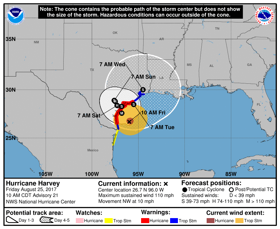
Irma will be moving westward in a very favorable environment for several days and should bring Irma to a Cat 4 storm within 24 hours. A turn to the west is expected later today or tonight then a more west-northwest track is expected for the next few days. Beyond 5 days, a turn to the northwest or north is anticipated by most models.

NOAA NHC Forecast track for Hurricane Irma
Current Warnings and Watches
A HURRICANE WARNING IS IN EFFECT FOR…
* ANTIGUA…BARBUDA…ANGUILLA…MONTSERRAT…ST. KITTS…AND NEVIS
* SABA…ST. EUSTATIUS…AND SINT MAARTEN
* SAINT MARTIN AND SAINT BARTHELEMY
A HURRICANE WATCH IS IN EFFECT FOR…
* GUADELOUPE
* BRITISH VIRGIN ISLANDS
* U.S. VIRGIN ISLANDS
* PUERTO RICO…VIEQUES…AND CULEBRA
A TROPICAL STORM WATCH IS IN EFFECT FOR…
* DOMINICA
Longer-term risk currently appears to be from the southern Bahamas, Hispaniola, Cuba and South Florida. The current track projections remind me of Hurricane Donna in 1960.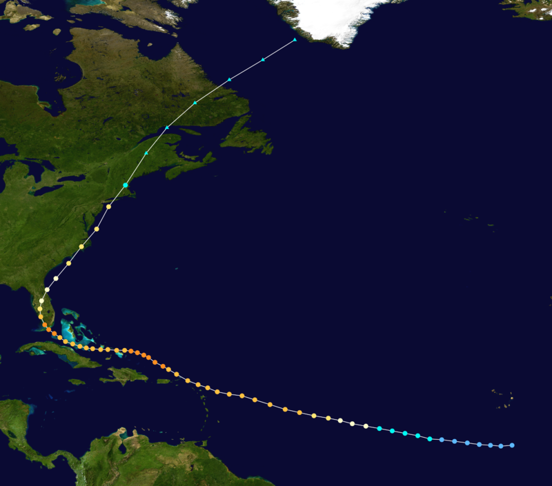
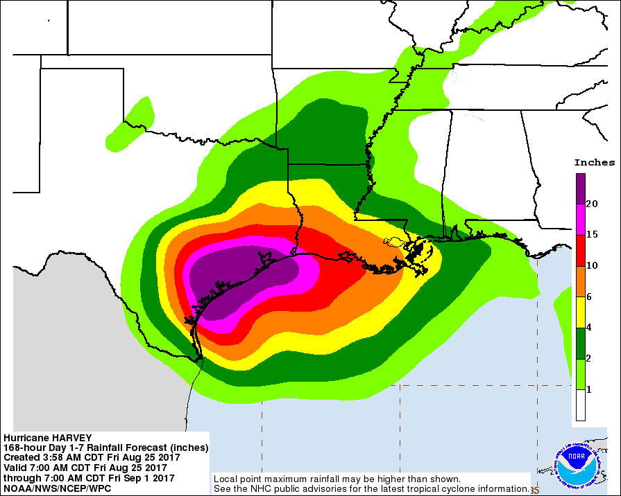
Below is the risk for encountering at least 50 knot or higher winds:
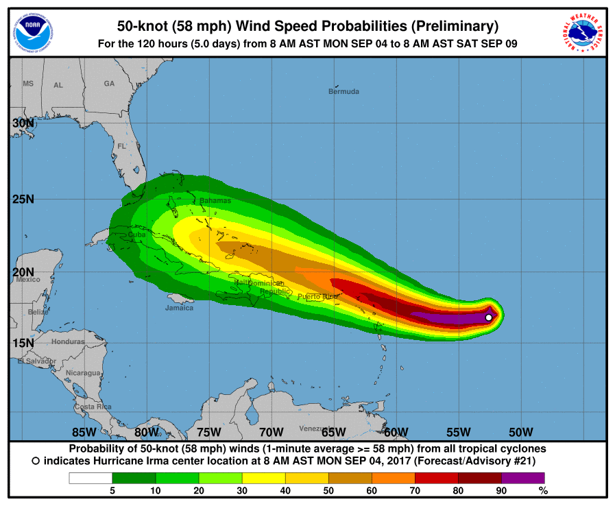
Risk for encountering at least 50 knot wind during the next 5 days


