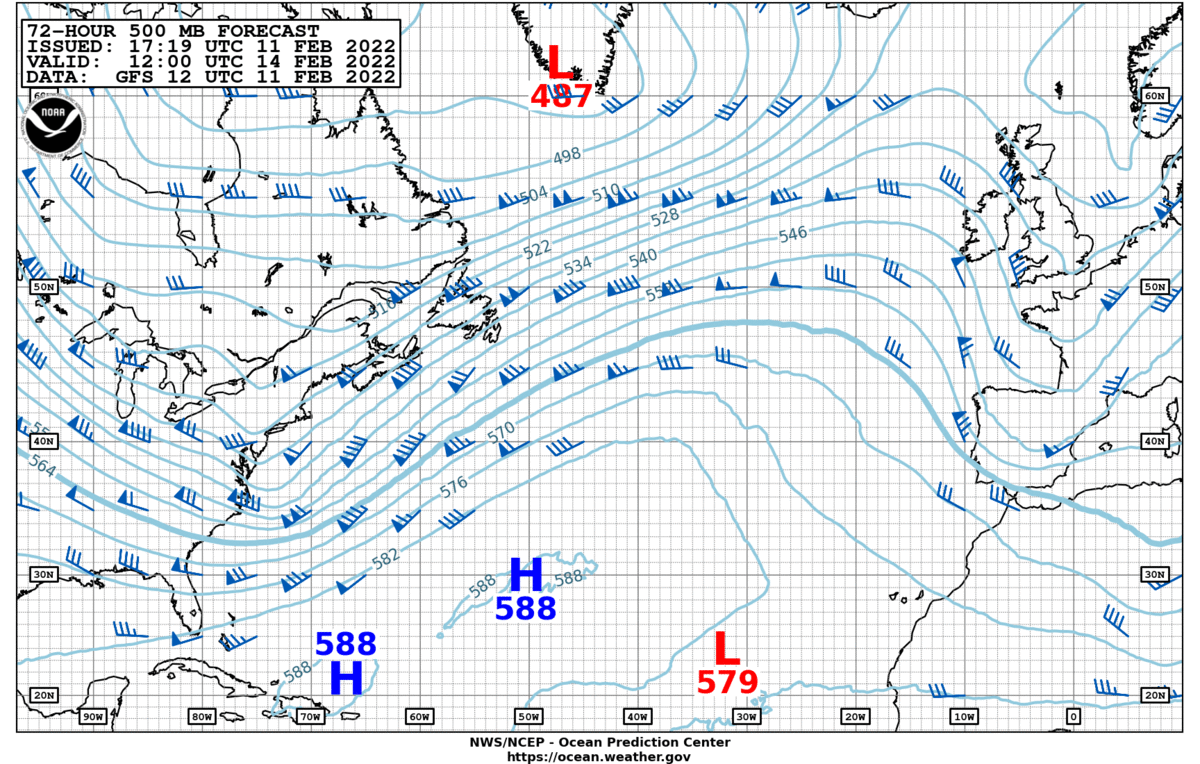
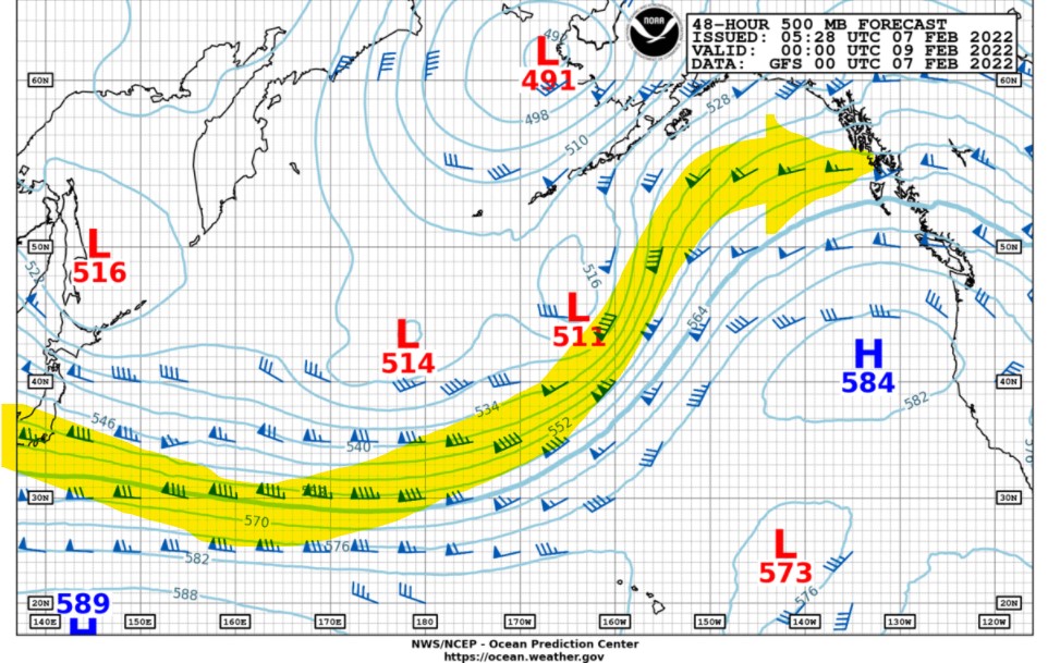
NOAA OPC 500 mb Forecast chart
Active weather system will continue over the western and central North Pacific this week.
The upper-level jet remains depressed south of 35 N latitude over the western-most North Pacific but then turns northeastward towards Alaska as a blocking ridge continues to remain over the eastern North Pacific.

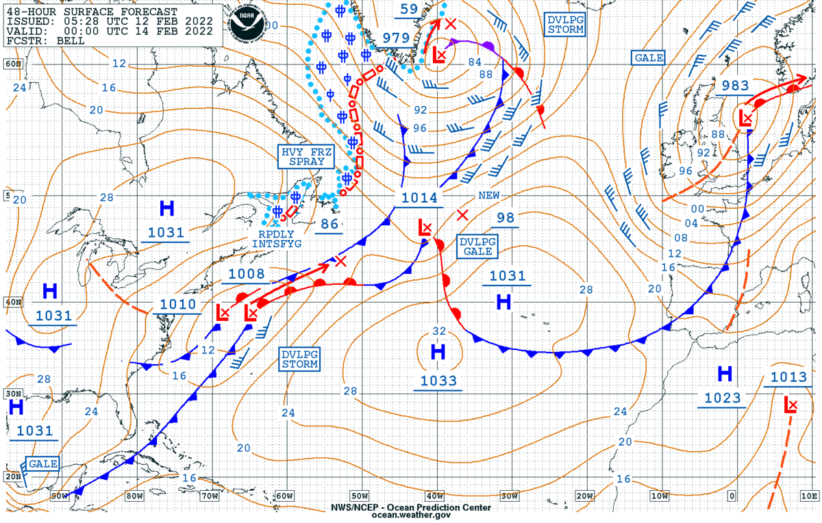
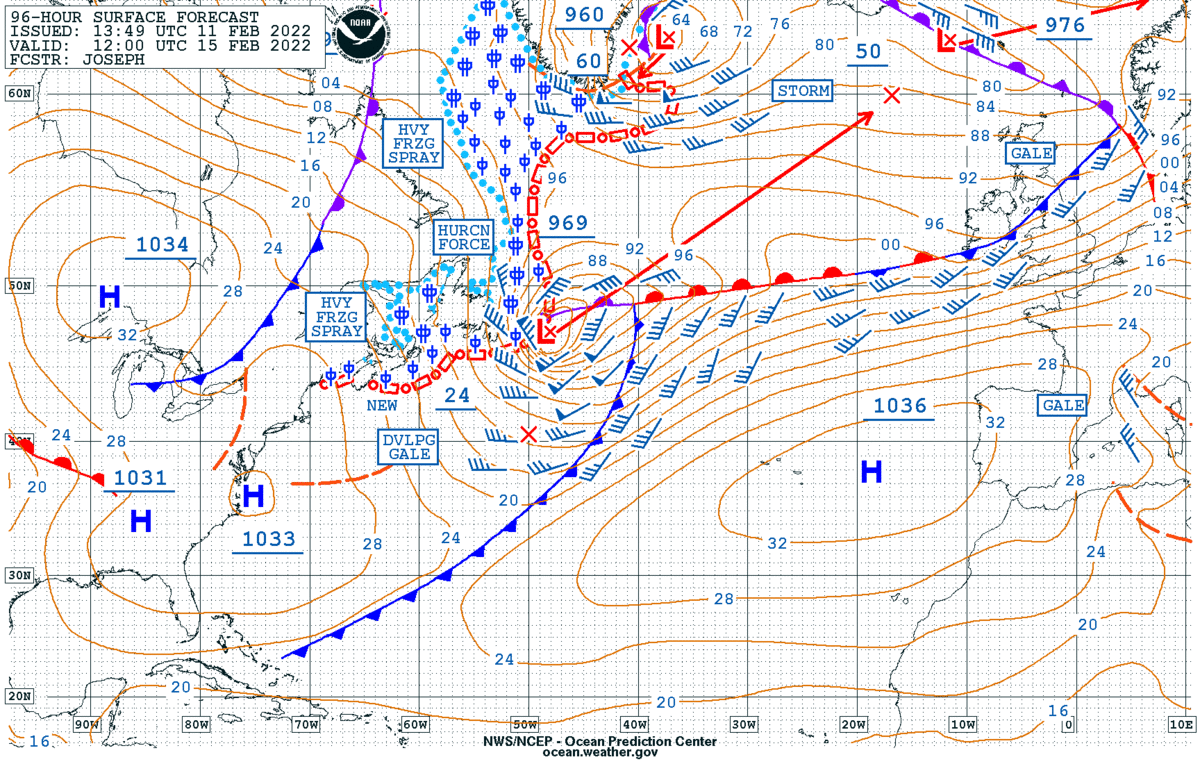
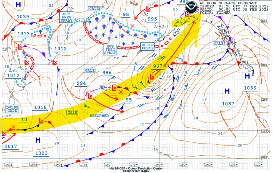
NOAA OPC Surface Forecast chart
The primary storm tracks will be from Japan northeastward over the eastern Bering Sea and over Alaska. Frequent gale to storm force to occasionally hurricane force winds are likely near and south of low pressure centers.