NOAA OPC North Pacific surface Analysis
A huge complex low pressure system dominates the North Pacific this morning.
The upper-level jet remains displaced south of 40-45 N latitude and will spread eastward into the eastern North Pacific as the blocking ridge over the easternmost North Pacific weakens and moves southeastward.

NOAA OPC 72 hour 500 mb Forecast
This will set-up a primary storm track from east of Japan to near 40N/175W then northeastward over the eastern Gulf of Mexico.

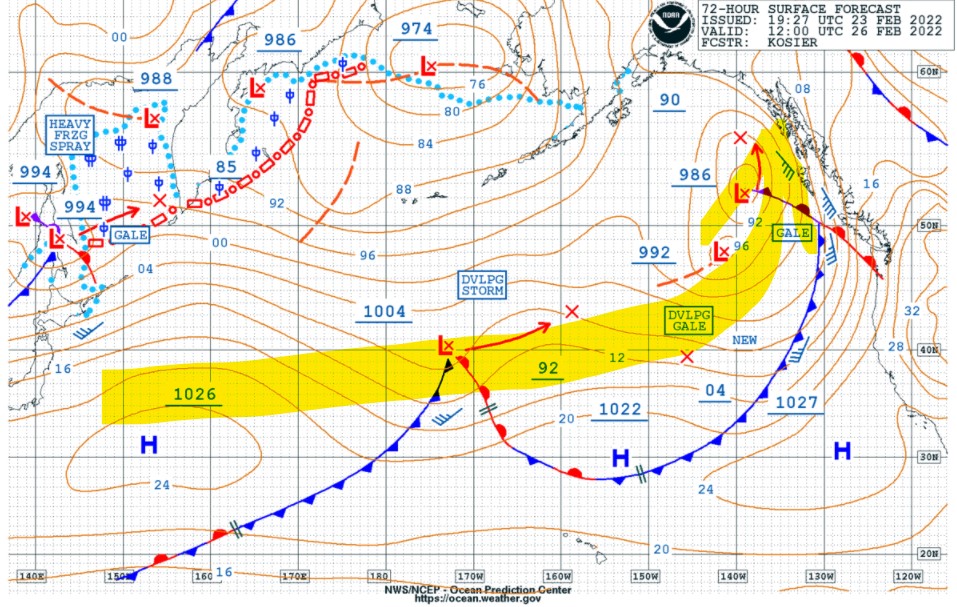
NOAA OPC 72 hour Surface Forecast
Frequent gale to storm conditions are likely near and south of the storm tracks for the next several days.
Post Views:
516
About Fred Pickhardt
I am a marine meteorologist and sailed briefly with American Export Lines in the Far East trade after graduating from State University of New York Maritime College. I have extensive experience in weather analysis, weather forecasting, optimum ship routing, vessel performance evaluations and forensic weather event reconstructions. I founded Ocean Weather Services and as Owner and Chief Consultant currently provide optimum ship routing services and forensic marine weather reports to the maritime industry.


