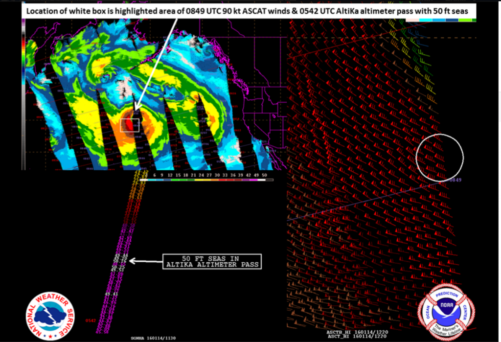
The intense and dangerous North Pacific storm continues to pack winds to 90 knots and wave heights to 50 feet (15.2 meters) this morning. From NOAA OPC’s post this morning :
“The 0600 UTC GOES-W enhanced infrared satellite image along with a portion of the 06Z OPC Pacific surface analysis shows a powerful 948-mb hurricane force low pressure system in the central Pacific. In addition, the 0849 UTC ASCAT wind retrievals from this morning showed an impressive wind field with values up to 90 knots (~104 mph) in the strong cold advection in the south quadrant of the low center. The 0542 UTC AltiKa altimeter pass from that same area was equally spectacular with values up to 50 feet!
As a reminder, a system is classified as “hurricane force” when the winds are equal to or greater than 64 knots (~74 mph).”
Please visit the OPC’s Pacific page on the main website for additional analysis and forecast products:


