Super Typhoon Meranti Monday Update


NOAA IR Satellite Image

NOAA IR Satellite Image

Super Typhoon Meranti has deepened rapidly over the past 24 hours and now has peak winds of 155 knots with gusts to 190 knots as it moves WNW at about 12 knots.

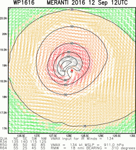
The radius of hurricane force winds extend 45 NM to the south and 60-100 NM to the north.  50 knot or higher winds extend outward 60NM to the southwest and 115NM to the northeast. Maximum significant wave heights are estimated to be about 47 feet (14.3 meters).

Estimated Wind Field Super Typhoon Meranti Max wind 155 knots.

Estimated Wind Field Super Typhoon Meranti Max wind 155 knots.


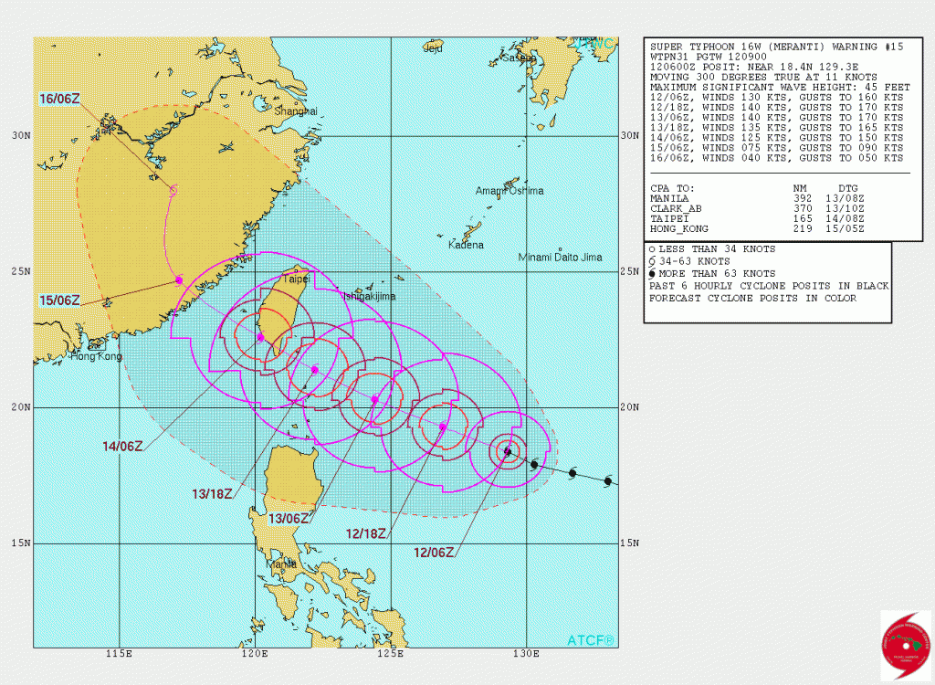
Meranti is forecast to maintain this intensity for another 12-18 hours before slowing weakening.  Max winds will still likely be 130-140 knots as it nears the southern tip of Taiwan during the 14th between 00-06 UTC.  The current track takes the center over the southern tip of Taiwan but some models show it passing just southward of Taiwan over the Luzon Strait.

JTWC Forecast Track

JTWC Forecast Track

About Fred Pickhardt

I am a marine meteorologist and sailed briefly with American Export Lines in the Far East trade after graduating from State University of New York Maritime College. I have extensive experience in weather analysis, weather forecasting, optimum ship routing, vessel performance evaluations and forensic weather event reconstructions. I founded Ocean Weather Services and as Owner and Chief Consultant currently provide optimum ship routing services and forensic marine weather reports to the maritime industry.
This entry was posted in Ocean Storms, Tropical Cyclones and tagged , , , , , , . Bookmark the permalink.

Leave a Reply

Your email address will not be published. Required fields are marked *