
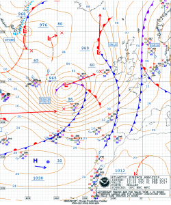
1200 UTC NOAA OPC Surface Analysis Feb 01 2017
An intense storm low over the eastern North Atlantic with storm to hurricane force winds and seas to 14 meters (46 feet) will turn northeast then northward passing just west of Ireland. A rapidly deepening low will develop over the central North Atlantic in 24-36 hours deepening and moving ENE to near Brest in northwest France within 72 hours. This will bring storm to hurricane force winds and seas into the Bay of Biscay and the English Channel approaches.

Meteosat photo 01 Feb 2017
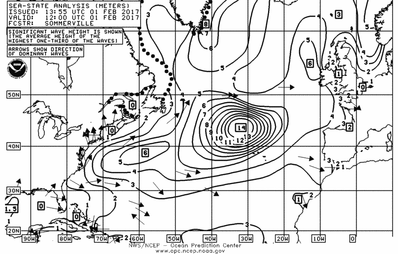
1200 UTC NOAA OPC Wave Analysis Feb 01 217
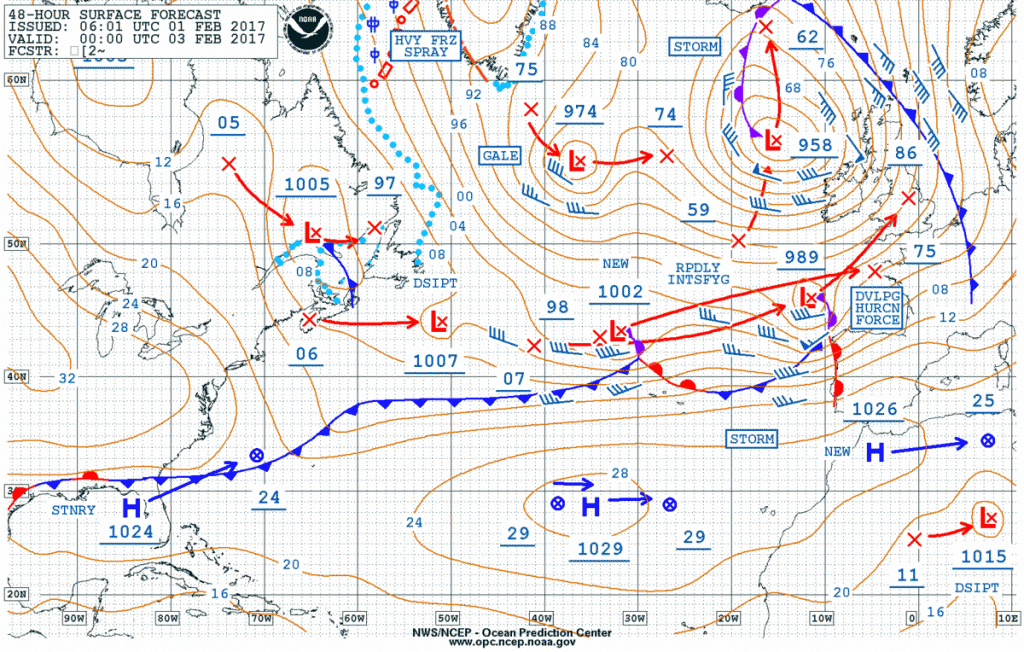
000UTC NOAA OPC Surface Forecast 03 Feb 2017