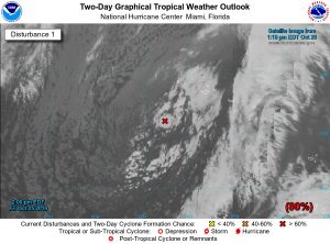
Tropical Storm Pablo forms southwest of Azores

Satellite Image

NOAA Satellite Image North Atlantic

A new tropical cyclone has formed within a larger extratropical cyclone in the northeastern Atlantic. Pablo is a very small-scale tropical cyclone, but satellite data clearly show a well-defined but small circulation with 40-kt winds embedded within the larger low.

Pablo is currently moving toward the east-southeast at about 9 kt while embedded within the circulation of the larger extratropical low. Pablo should then turn toward the northeast and increase its forward speed with some strengthening possible over the next 36 hours.

NOAA NHC Forecast Track


Note the larger scale low is currently causing winds of 30 to 45 knots and seas to 9 meters (about 30 feet).

NOAA OPC Wave Height Analysis

About Fred Pickhardt

I am a marine meteorologist and sailed briefly with American Export Lines in the Far East trade after graduating from State University of New York Maritime College. I have extensive experience in weather analysis, weather forecasting, optimum ship routing, vessel performance evaluations and forensic weather event reconstructions. I founded Ocean Weather Services and as Owner and Chief Consultant currently provide optimum ship routing services and forensic marine weather reports to the maritime industry.
This entry was posted in NOAA OPC, Ocean Storms, Tropical Cyclones and tagged , , , , . Bookmark the permalink.

Leave a Reply

Your email address will not be published. Required fields are marked *