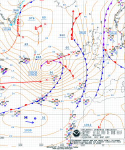
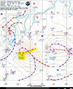
NOAA OPC Surface Analysis
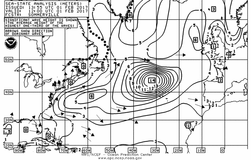
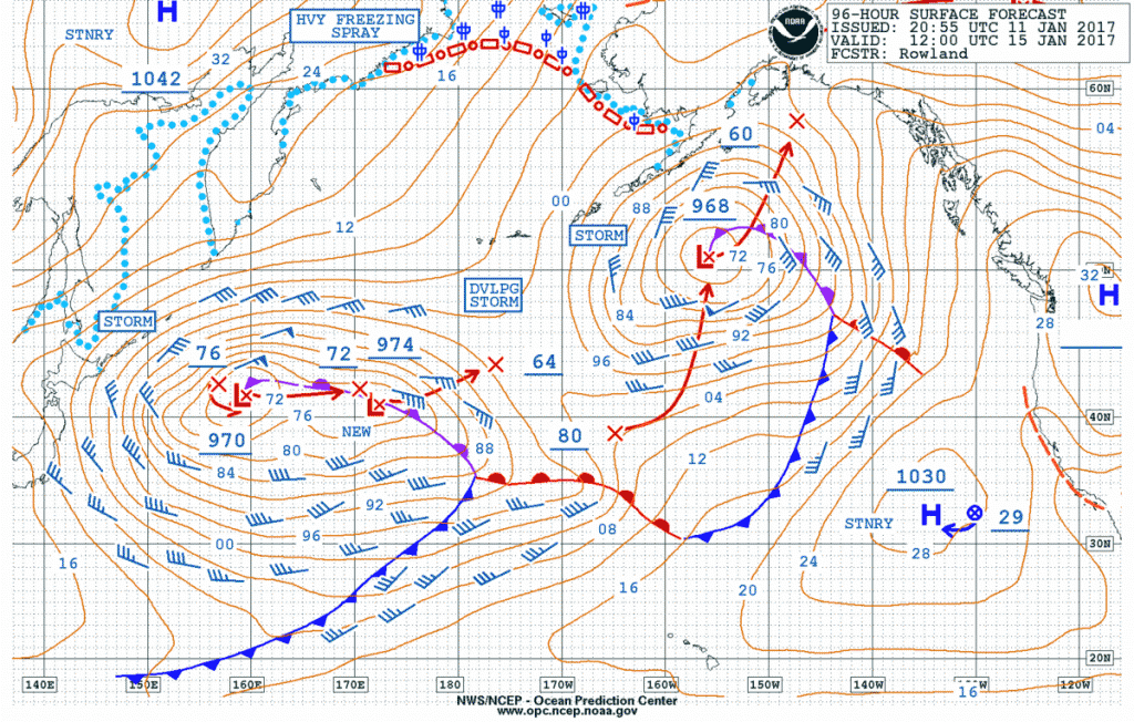
As of 0600 UTC 06 February, an intense hurricane force 932MB low was moving northward over the eastern North Atlantic is producing storm force winds outward 350-450 NM of the center and hurricane force winds (up to 80 knots) between 90-170 NM south and southeast of the center. Wave heights in the area are estimated to be up to 15 meters (almost 50 feet).
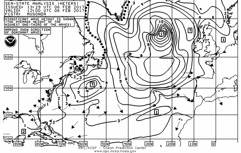
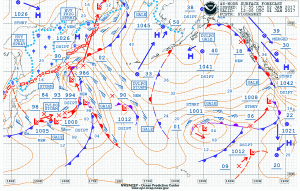
NOAA OPC1200 UTC 06 Feb. 2017 Wave Height Analysis

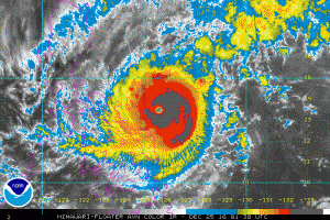
ASCAT (METOP-B) Satellite Winds showing winds to 80 knots.