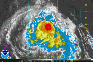
NOAA Satellite image TS Jose
Tropical Storm Jose as of 2100 UTC (5PM EDT) on Sept. 14th was moving towards the west-northwest at 7 knots over the western North Atlantic with a max wind of about 60 knots. Jose is moving over an area that favors some strengthening during the next 72 hours and should regain hurricane strength as a Cat. 1-2 hurricane.
Jose should turn northwestward by Saturday and northward by early Monday while it moves around a ridge over the western Atlantic Ocean staying off the US East Coast, however, there is some indication that the forecast track could be adjusted farther west.

NOAA NHC Forecast Track
Post Views:
611
About Fred Pickhardt
I am a marine meteorologist and sailed briefly with American Export Lines in the Far East trade after graduating from State University of New York Maritime College. I have extensive experience in weather analysis, weather forecasting, optimum ship routing, vessel performance evaluations and forensic weather event reconstructions. I founded Ocean Weather Services and as Owner and Chief Consultant currently provide optimum ship routing services and forensic marine weather reports to the maritime industry.


