
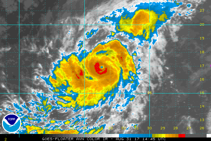
NOAA Satellite image Hurricane Irma
Irma has intensified rapidly and is now a Hurricane with max winds to 85 knots as it moves WNW at about 9 knots. Hurricane force winds are estimated to extend outward 10-15 NM on the east side of the circulation. The forecast track takes Irma over somewhat cooler ocean temperatures, however, max winds could still reach or exceed 100 knots. In a few days, the hurricane will be moving over warmer waters again so additional strengthening is likely.
Irma is forecast to track westward or west-southwestward for several days before turning back towards the west-northwest. Irma will likely threaten the Leeward Islands and Puerto Rico as a major hurricane next Wednesday and Thursday and eventually could threaten Cuba, the Bahamas and Florida thereafter.

NOAA NHC Hurricane Irma forecast track