Two Tropical Cyclones developing over the South Indian Ocean

First Tropical Cyclone

Satellite IR image TC 02S

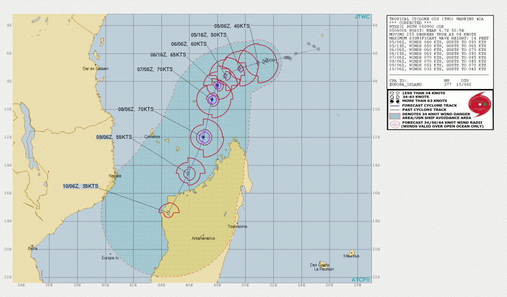
Tropical Cyclone (02S) has formed over the South Indian Ocean NNW of St Denis, Reunion and is moving WSW at about 4 knots with max winds of 40 knots. This system is moving through an area of low vertical wind shear and warm ocean temperatures so deepening to hurricane strength is expected within 36-48 hours.  A more S-SW track is expected bring the system near the northwest coast of Madagascar in 4-5 days. 

TC 02S Forecast track


Second Tropical Cyclone

TC Ambali Satellite Image

A second Tropical Cyclone (Ambali) has formed WSW of Diego Garcia over the southern Indian Ocean and was moving SW at 8 knots with max winds already at 70 knots. Ambali has been rapidly deepening over warm ocean water with low vertical wind shear. Ambali could reach a max intensity of 100 knots or more over the next 12-24 hours. Gradual weakening is expected after 24-36 hours as Ambali continues on a SW track. 

TC Ambali Track Forecast

About Fred Pickhardt

I am a marine meteorologist and sailed briefly with American Export Lines in the Far East trade after graduating from State University of New York Maritime College. I have extensive experience in weather analysis, weather forecasting, optimum ship routing, vessel performance evaluations and forensic weather event reconstructions. I founded Ocean Weather Services and as Owner and Chief Consultant currently provide optimum ship routing services and forensic marine weather reports to the maritime industry.
This entry was posted in Ocean Storms, Tropical Cyclones and tagged , , . Bookmark the permalink.

Leave a Reply

Your email address will not be published. Required fields are marked *